


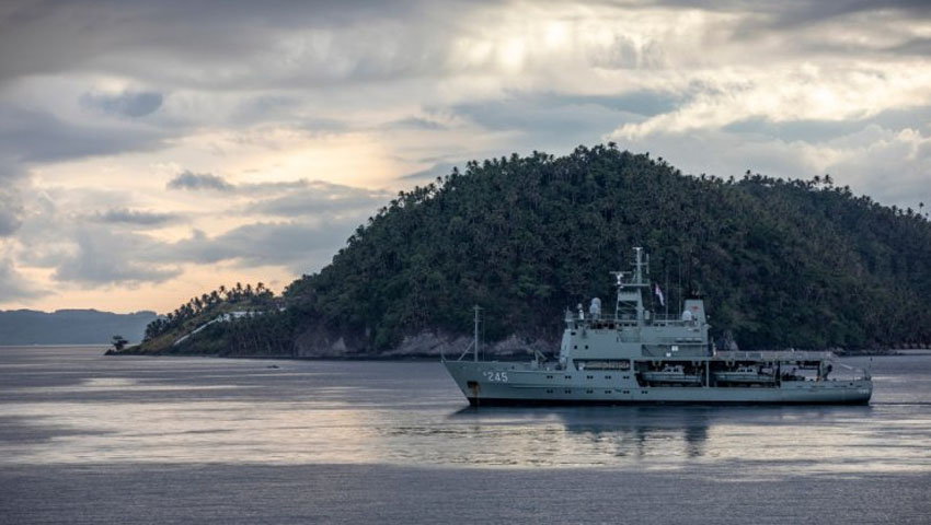
The Royal Australian Navy’s hydrographic survey ship HMAS Leeuwin has spent the last two weeks conducting intensive training and evaluation in beautiful weather off Mission Beach, 140 kilometres south of Cairns, in preparation for operational taskings later this year.
The training follows a major maintenance period in June, when the ship slipped at Tropical Reef Shipyard for over eight weeks ahead of fleet duties later this year.
Maritime Geospatial Officer - Hydrographic Lieutenant Leigh Guilmartin said the crew had welcomed the opportunity to get back on the water to test their mariner and hydrographic survey skills, including ship handling, damage control, machinery breakdowns and survey and geospatial data collection by both the ship and her embarked survey boats.
"It has been really enjoyable to conduct this training so close to home – a lot of us have travelled to Mission Beach previously, but it isn’t every day that you get to visit somewhere like Dunk Island for work," LEUT Guilmartin said.
The training will lay the groundwork for future survey tasks, both in Australia and overseas, with Leeuwin having completed multiple visits to Pacific neighbours throughout 2019 and early 2020, including the Federated States of Micronesia, Palau, Timor Leste, and Vanuatu.
LEUT Guilmartin added, "We also validated an area which will be useful for future pre-survey equipment checks, allowing us to ensure our equipment is working exactly how it should before we conduct surveys for chart development."
Leeuwin Commanding Officer Commander Matthew Richardson, said that the crew’s preparation, training and enthusiasm allowed them to respond effectively to the complex training scenarios.
"The pre-workup training undertaken earlier in the year has been evident, particularly through the damage control and multi-scenario exercises. Everything that was thrown at the team was taken in their stride and they have improved and improved throughout the entire process," CMDR Richardson said.
HMAS Leeuwin returned to her homeport in Cairns after unit readiness evaluation for a short maintenance period and is expected to deploy again in September.
The RAN currently uses the Leeuwin Class AGS. The RAN Hydrographic Service has responsibility for charting more than one-eighth of the world's surface, stretching as far west as Cocos Island in the Indian Ocean, east to the Solomon Islands, and from the equator to the Antarctic.
The RAN has six ships and one aircraft engaged in this paramount and vital task. The nautical charts developed from data gathered by the Hydrographic Service are essential for safe navigation at sea.
Around Australia, less than half of the area has been surveyed to acceptable standards, however the two Leeuwin Class ships, with multi-beam echo sounders, will greatly reduce this figure, making passage of vessels safer and further protect Australia's ocean environment.
Leeuwin Class ships, HMA Ships Leeuwin and Melville, have the ability to support a helicopter, and carry three nine-tonne survey motor boats.
Want to see more stories from trusted news sources?
Make Defence Connect a preferred news source on Google.
Click here to add Defence Connect as a preferred news source.