


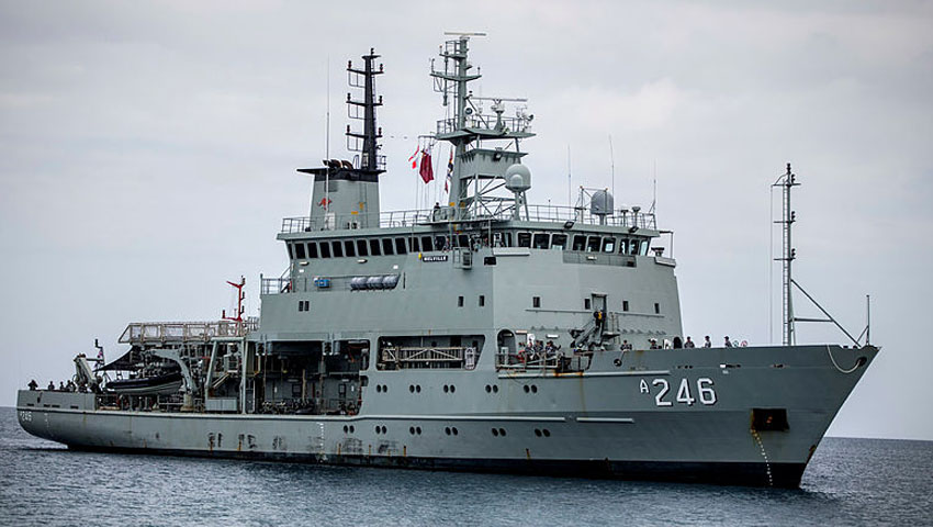
One of the Royal Australian Navy’s specialised hydrographic ship, HMAS Melville, aptly marked World Hydrography Day at sea on 21 June, as the hydrographic survey crew continued operations in the Shoalwater Bay area.
The importance of the deployment is crucial to the continued appreciation of the changing environment, particularly by the forces that participate in Exercise Talisman Sabre, which is conducted in the area every second year.
Melville’s work will improve charting accuracy and strengthen the knowledge of local tidal dynamics within the central Queensland coastal region.
Executive Officer, HMAS Melville Lieutenant Commander Adrian Eddy explained that a better understanding of the space above and below the water, the war fighter could take advantage of the information provided – both tactically and strategically – to allow them to gain the edge over an opponent.
"Our supporting role is to collect, decipher and disseminate to those who require it for decision-making purposes, either in real time or the more traditionally known methodical survey," LCDR Eddy said.
In 2019, Melville first deployed three Slocum Gliders as part of the SEA 2400 trials to collect deep oceanographic data over a four-week survey period.
In tune with this year’s theme of autonomous technologies, Melville deployed the gliders again on World Hydrography Day. Maritime geospatial officer – hydrographic, Lieutenant Djena Jordan, has been conducting survey operations on board Melville since 2018.
"These gliders are piloted remotely from Western Australia by military and civilian personnel and can provide critical real-time data for planning purposes. Autonomous technology that can be launched locally, yet piloted remotely, is an invaluable tool in gleaning accurate information," LEUT Jordan explained.
Melville will finalise survey work in another part of the area in the coming weeks with updated tidal and bathymetric information. By understanding what lies beneath the water, hydrographers allow maritime units to navigate more confidently.
The Royal Australian Navy currently uses the Leeuwin Class AGS.
The RAN Hydrographic Service has responsibility for charting more than one-eighth of the world's surface, stretching as far west as Cocos Island in the Indian Ocean, east to the Solomon Islands, and from the equator to the Antarctic. The RAN has six ships and one aircraft engaged in this paramount and vital task.
The nautical charts developed from data gathered by the Hydrographic Service are essential for safe navigation at sea.
Around Australia, less than half of the area has been surveyed to acceptable standards, however the two Leeuwin Class ships, with multi-beam echo sounders, will greatly reduce this figure, making passage of vessels safer and further protect Australia's ocean environment.
Leeuwin Class ships, HMA Ships Leeuwin and Melville, have the ability to support a helicopter, and carry three nine-tonne survey motor boats.
Want to see more stories from trusted news sources?
Make Defence Connect a preferred news source on Google.
Click here to add Defence Connect as a preferred news source.